
Drone Sky Check – UAS Traffic & Remote ID Visualization (Italy)
Drone Sky Check is a situational awareness platform designed to support safe and informed drone operations by combining airspace information with UAS traffic visualization.
The project was born as a flight planning tool focused on the Italian airspace, but it is progressively evolving into a neutral visualization layer for UAS traffic data, including Remote ID–based sources.
Drone Sky Check is not a tracking service, not a surveillance system, and not a compliance tool.
It is a contextual platform: data only becomes useful when it is correctly interpreted within airspace rules, constraints, and operational context.
Why UAS Traffic Visualization Matters
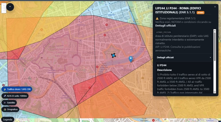
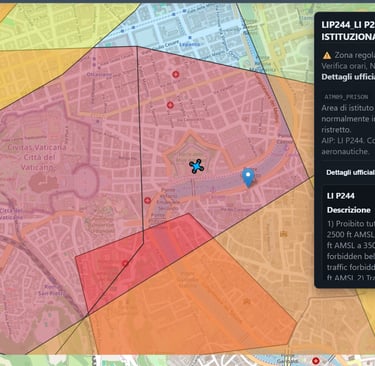
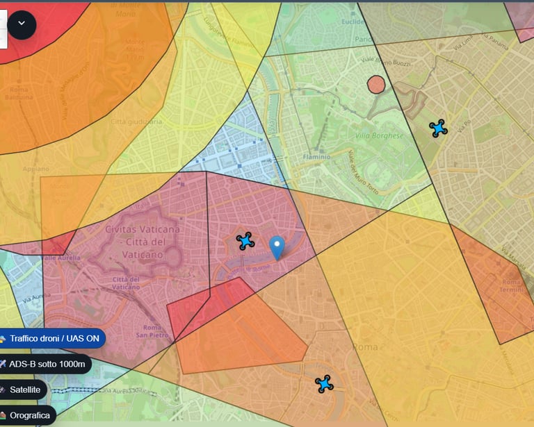
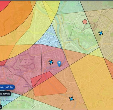
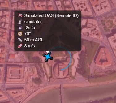
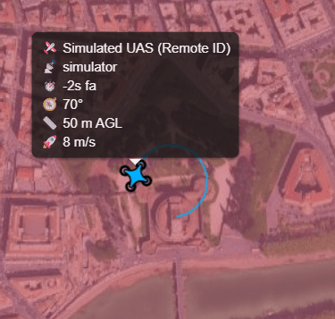
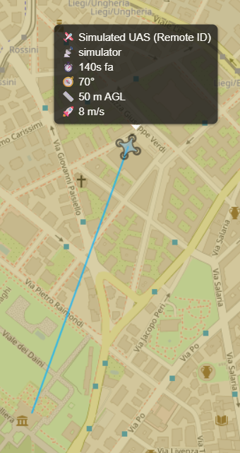
Remote ID and UAS detection systems generate valuable data, but raw data alone is rarely useful.
Without context, a position is just a coordinate.
With airspace awareness, it becomes operational information.
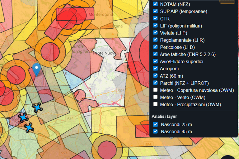
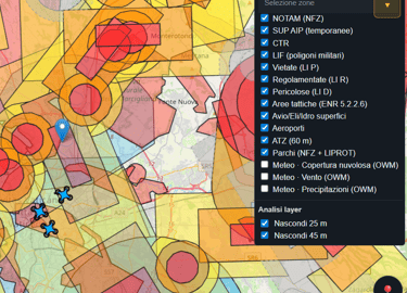
Drone Sky Check already handles:
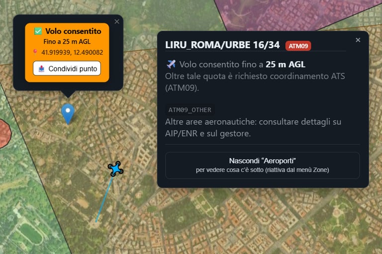
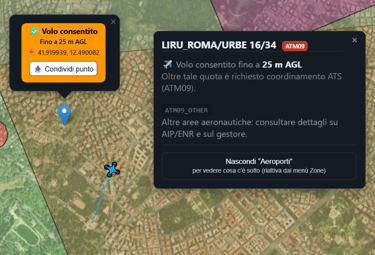
controlled and restricted airspace
flight limitations and altitude constraints
aeronautical areas and special use airspace
local airspace logic specific to Italy
By visualizing UAS traffic together with airspace data, Drone Sky Check provides an immediate understanding of where drones are operating and in what context.
An Open and Neutral Approach
Drone Sky Check is designed as an open platform, not a closed ecosystem.
The goal is not to replace existing solutions, but to offer a common visualization layer where different data sources can coexist:
Remote ID receivers
UAS detection systems
experimental sensors
research and testing setups
The platform intentionally avoids vendor lock-in and proprietary formats whenever possible.
Who This Is For
Drone Sky Check may be relevant for:
manufacturers of Remote ID receivers
developers of UAS traffic monitoring systems
system integrators working on airspace awareness
researchers and experimental projects
developers interested in testing data flows and visualization
Both commercial and non-commercial use cases are considered, as long as the intent is technical, experimental, or operational support.
Transparency and Privacy
Drone Sky Check does not require personal data to visualize UAS traffic.
The platform focuses on objects and airspace, not on identifying pilots or operators.
No claim is made regarding law-enforcement use, surveillance, or enforcement.
Drone Sky Check is a situational awareness tool, not a policing system.
Italy-Focused, Open to the World
Drone Sky Check is currently focused on the Italian airspace, with logic and data sources aligned to local regulations and aeronautical publications.
At the same time, the technical approach is intentionally generic, allowing:
experimentation
data integration
collaborative development
International contributors, developers, and companies are welcome to explore integration possibilities and exchange technical ideas.
Get in Touch
If you are working on:
Remote ID
UAS traffic monitoring
detection or visualization systems
experimental or research projects
and you are interested in visualizing or testing UAS traffic data within Drone Sky Check, feel free to get in touch to discuss technical integration possibilities.
This project grows through collaboration, not gatekeeping.

Technical Integration
Drone Sky Check exposes a simple and open ingest interface for UAS traffic data.
A public reference implementation, JSON payload schema, and integration examples are available on GitHub.
The repository is intended as technical documentation and a shared data contract, not as a mandatory SDK.
👉 GitHub repository (reference implementation):
https://github.com/iz0qwm/drone-sky-check-ingest
Authentication is currently minimal and based on feeder identification.
This is intentional, to allow experimentation and early integrations with low friction.
The security model will evolve as real-world integrations mature.
Contatti
Per collaborazioni, domande o semplicemente per scambiare idee sul mondo dei droni e della tecnologia, puoi contattarmi qui.
Se vuoi entrare nella nostra community e parlare con altri appassionati, unisciti al gruppo Telegram dedicato.
In alternativa, mi trovi anche su tutti i principali social: rispondo sempre volentieri!
Telegram
© 2025. All rights reserved.